About All Tours From Chiang Mai ToursPrivate ToursElephant Sanctuary ToursHiking Tours Directions Hours & Fees Guides
Find Tours 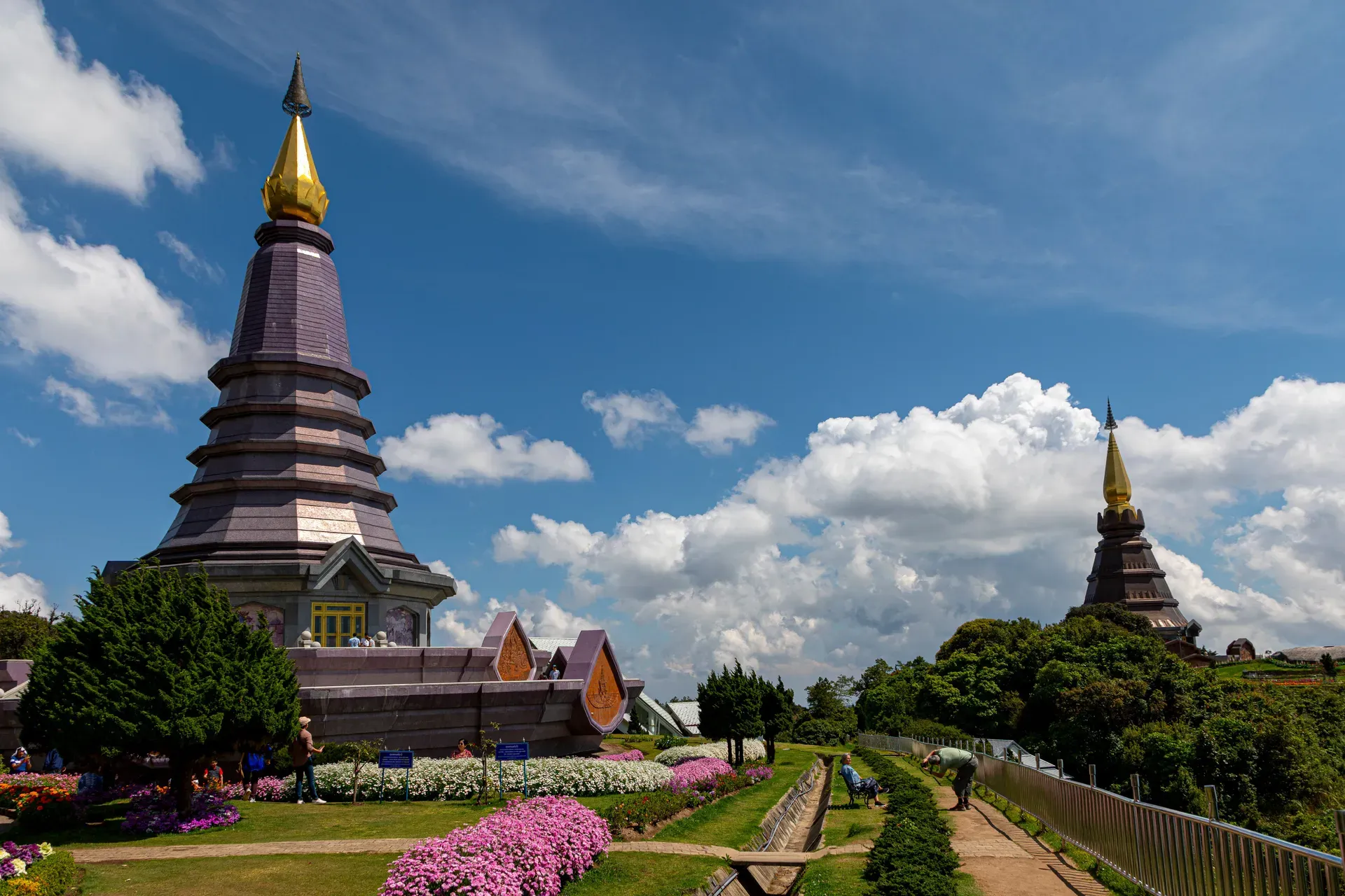
Doi Inthanon National Park covers 482 square kilometers of the Thanon Thong Chai Range in northern Thailand. It contains the country's highest peak at 2,565 meters and its only sphagnum bog cloud forest.
Doi Inthanon National Park occupies 482 square kilometers of the Thanon Thong Chai Range in northern Thailand. The park rises from 800-meter lowlands to the 2,565-meter summit of Doi Inthanon, the highest point in the country. This massive elevation shift creates distinct, stacked ecosystems. Mixed deciduous forests cover the hot, dry lower slopes. Above 1,800 meters, the environment transitions sharply into moist evergreen cloud forest and Thailand's only sphagnum bogs.
The park sits 70 kilometers southwest of Chiang Mai city. It feeds the Ping River watershed through a network of major waterfalls, including Mae Klang, Wachirathan, Siriphum, and Mae Ya. Wachirathan is the most accessible and visually forceful. Water blasts over a granite ledge just off the main road. It throws heavy mist that often forms rainbows in the mid-morning sun. The rocks around the plunge pool are slick with constant spray. Skip swimming. Stay on the designated viewing platforms.
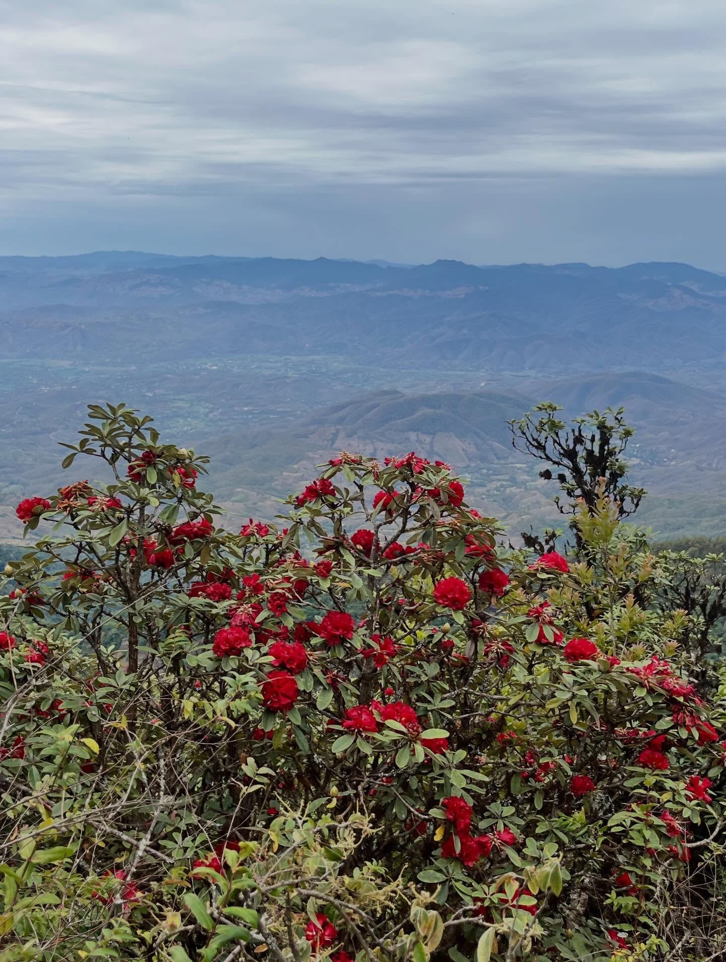
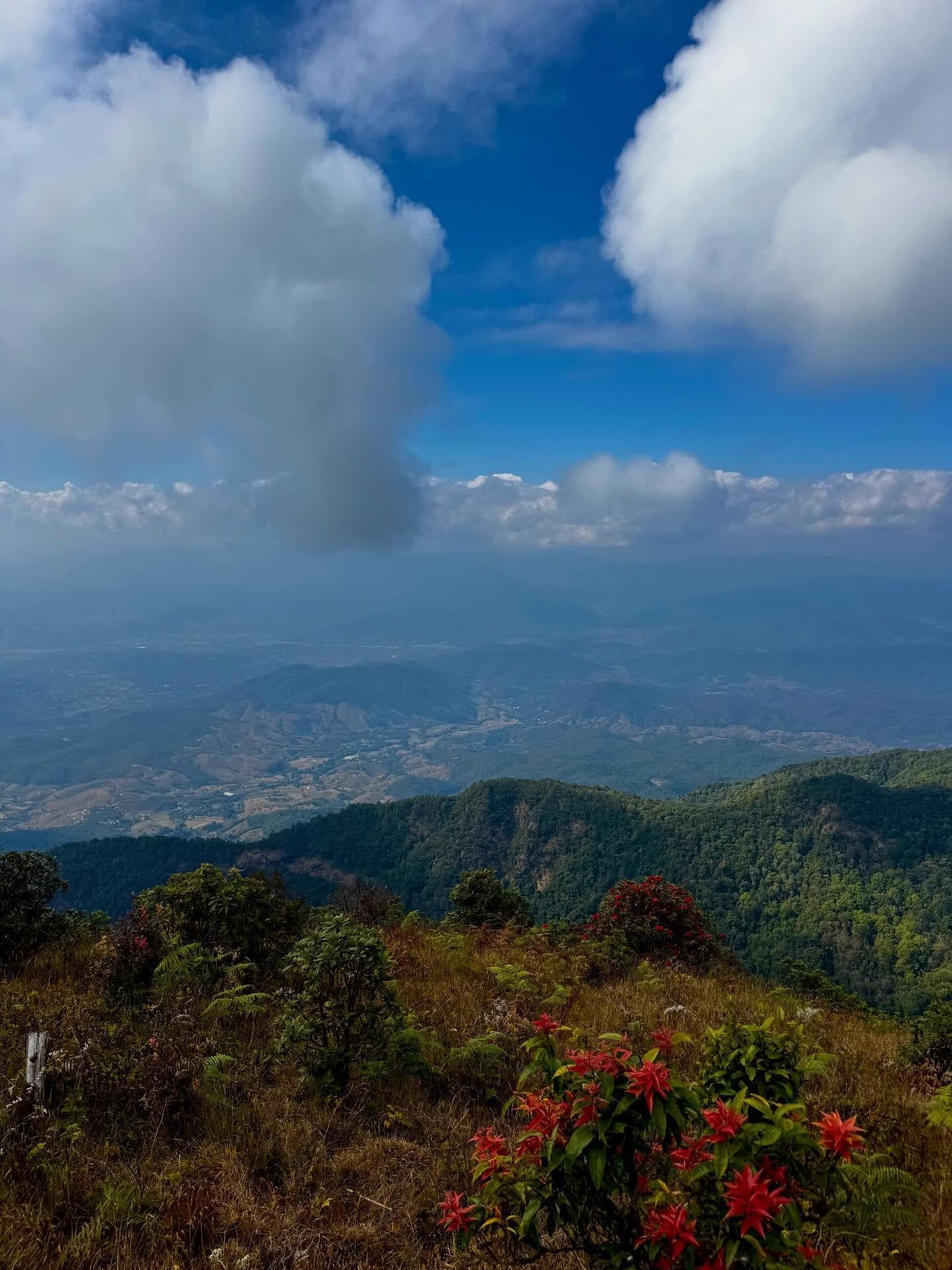
Most visitors arrive on day trips from Chiang Mai, spending eight to ten hours covering the main sites. A paved, winding two-lane road runs all the way to a parking lot near the summit. You'll find the Royal Twin Pagodas on a terraced ridge just below the peak. The Kew Mae Pan Nature Trail starts nearby at kilometer marker 42. This 3-kilometer loop requires a local Hmong guide, costing 200 Baht per group. The trail skirts a high, exposed ridge dotted with pines and red rhododendrons. It closes entirely from June to October to let the forest recover from monsoon rains. Go between November and February for clear skies and a chance to see the morning mist pooling in the valleys below. March and April bring dry, hazy conditions as agricultural burning smoke drifts across northern Thailand. The rainy season from May to October turns the waterfalls into roaring torrents but makes the trails muddy and prone to closure.
Getting there requires some planning. Public songthaew trucks run from Chom Thong. They are slow, require multiple transfers, and only reach a few roadside falls. Renting a car or hiring a private driver gives you the flexibility to hit the summit early and stop at the scattered attractions on your way back down. Traffic gets heavy. On public holidays like New Year, thousands of vehicles jam the steep summit road, turning a 90-minute drive into a three-hour slog. Visit on a weekday if your schedule allows. The park gates open at 5:30 am. Leave Chiang Mai by 6:00 am to beat the tour vans.
The mountain was originally called Doi Luang, meaning "great mountain" in the northern Thai dialect. Forests on its slopes received their first formal conservation protections in 1954. The Thai government officially gazetted the area as the country's sixth national park on 2 October 1972. The boundaries expanded in 1978 and again in 2009 to reach the current 482-square-kilometer footprint. Before the paved road was constructed in the 1970s, reaching the summit required a multi-day trek through dense jungle. The Royal Thai Air Force built a radar station at the peak to monitor the airspace near the Myanmar border. This infrastructure opened the mountain to mass tourism.
The park takes its modern name from King Inthawichayanon. He was one of the last rulers of the Lanna Kingdom in Chiang Mai during the late 19th century. He recognized the ecological value of the northern watershed and pushed to protect the highland forests from unchecked logging. Before his death in 1897, he requested that his remains be placed at the mountain's summit. A small stupa containing his ashes still sits near the highest point, accessible via a short paved walkway from the upper parking lot.
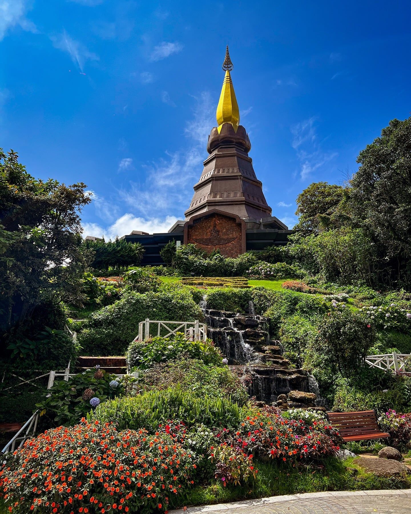
In the late 20th century, the Thai monarchy initiated several infrastructure and agricultural projects within the park boundaries. The Royal Thai Air Force built the Royal Twin Pagodas—Phra Mahathat Naphamethanidon and Naphamethanidon—in 1987 and 1992. These structures marked the 60th birthdays of King Bhumibol and Queen Sirikit. The Royal Agricultural Station Inthanon opened in 1979 near the summit road. This research facility developed temperate crops like coffee, strawberries, and flowers. The goal was to replace opium cultivation among the local Karen and Hmong hill tribes with legal, sustainable cash crops.
Today, the park manages heavy tourist traffic alongside active agricultural communities. Over 850,000 people visited in 2024. The influx strains infrastructure during peak holidays, prompting park authorities to implement stricter environmental controls. Single-use plastics were banned across all Thai national parks in April 2022. Rangers enforce mandatory guide rules on sensitive trails to prevent erosion and off-trail trampling. The DNP also operates a campground and bungalows near the headquarters. The online booking system frequently crashes, so you'll need to call the park office directly to reserve a tent for an overnight stay.
Granite and limestone form the geologic foundation of the park. The terrain drops sharply from the 2,565-meter peak, creating steep gradients that fuel massive waterfalls. Mae Ya Waterfall drops over 250 meters across a series of wide, fan-like limestone terraces. It sits in the southern section of the park, requiring a 40-minute drive from the main headquarters and a short hike from the parking area. That isolation keeps the crowds thin compared to the roadside falls.
The altitude dictates the vegetation. Lowland areas support dry dipterocarp forests that shed their leaves in the hot season from March to May. Above 1,800 meters, the temperature drops and the air holds more moisture. This zone contains a moist evergreen cloud forest. The Ang Ka Luang Nature Trail cuts through this high-altitude ecosystem. A raised wooden boardwalk loops for 360 meters through dense thickets of rhododendrons, ferns, and moss-draped trees. The sphagnum moss acts like a giant sponge. It absorbs moisture from the constant cloud cover and slowly releases it into the streams below. The steps are uneven and frequently slick with condensation. Walk carefully, especially after rain.
Siriphum Waterfall adds another distinct visual to the park. It flows in two parallel streams down a steep cliff face, visible from the main road near the Royal Agricultural Station. Unlike Wachirathan, you can admire Siriphum from a distance without getting soaked by the spray.
This varied habitat supports the highest avian diversity of any national park in Thailand. Biologists have recorded roughly 510 bird species here. The Green-tailed Sunbird and the Rufous-throated Partridge live exclusively in these high-elevation zones. Bird migration peaks between March and July, drawing ornithologists from across Asia.
The weather behaves differently here than in the rest of Thailand. The summit area averages 10 to 15°C year-round. Between November and February, nighttime temperatures frequently drop below freezing. On 2 January 2026, grass-top temperatures fell to minus 0.4°C. Frost coats the vegetation near the ranger stations during these cold snaps. Pack a heavy jacket, a hat, and gloves if you are driving up for sunrise. A t-shirt will leave you shivering at the viewpoint. Late January brings a brief, intense shift in the landscape's color palette. Siamese sakura trees (wild Himalayan cherry) bloom for just a few weeks, turning sections of the evergreen forest bright pink. The exact timing shifts slightly each year based on temperature drops. Check recent local reports before making the drive specifically for the flowers.
The mountain holds deep religious and historical weight for northern Thailand. The summit stupa containing King Inthawichayanon's ashes remains a site of active reverence. Thai visitors frequently leave offerings of fresh flowers and incense at the memorial. The Royal Twin Pagodas further cement the area's royal connections. These modern shrines house Buddha relics and feature intricate tile mosaics depicting scenes from the Buddha's life. They sit on landscaped terraces facing west, providing unobstructed views of the sunset over the Lanna hills. The pagodas require a separate 100 Baht entry fee. Dress with your shoulders and knees covered when visiting, out of respect for the site's sacred status.
Several Karen and Hmong communities live and farm within the park boundaries. Mae Klang Luang is a Karen village located six kilometers east of the park headquarters. The residents cultivate organic coffee and maintain terraced rice paddies that turn bright green during the late rainy season in September. They operate small cafes and homestays, providing a direct view into highland agricultural life. You can buy a cup of coffee roasted on-site, right next to the fields where the beans grew.
The nearby Hmong Market near Ban Khun Klang sells local produce, dried fruits, and traditional textiles. Buying directly from these stalls supports the local economy. The transition from opium farming to sustainable crops like coffee, cabbage, and strawberries stabilized these communities over the last four decades. Their continued presence makes the park a working landscape rather than just a protected wilderness. The Royal Agricultural Station Inthanon provides a closer look at this transition. For a 20 Baht entry fee, you can walk through ornamental gardens and greenhouses where researchers still test new crop varieties suited for the high altitude.
Before entering the park, many Thai visitors stop at Chom Thong town to visit Wat Phra That Si Chom Thong. This historic temple houses important Buddhist relics and is a spiritual gateway to the mountain. It is also the last reliable place to find an ATM. Bring enough cash in small denominations to cover your entrance fees, trail guides, and market purchases. Card readers are practically nonexistent once you start driving up the mountain. Local guides are mandatory on the Kew Mae Pan trail, and these guides come directly from the surrounding Hmong villages. The 200 Baht fee goes straight to the guide. This creates a direct financial incentive for the community to protect the trail's ecosystem. They know the ridge intimately and can spot wildlife that most hikers walk right past. Hire them gladly, and bring small bills to pay them directly at the trailhead desk.
The summit of Doi Inthanon is the highest point in Thailand at exactly 2,565 meters above sea level.
The park holds the record for the highest bird diversity in Thailand, with approximately 510 recorded species.
Wild Himalayan cherry trees bloom briefly in late January to early February, turning sections of the park bright pink.
Temperatures at the summit frequently drop below freezing in the cool season, with minus 0.4°C recorded on the grass in January 2026.
The park contains Thailand's only sphagnum bog ecosystem, located near the summit on the Ang Ka Luang trail.
Drones are strictly banned within the park boundaries, and unauthorized flights carry fines up to 100,000 Baht.
The Royal Agricultural Station Inthanon was established in 1979 to help local hill tribes transition from opium farming to growing coffee and strawberries.
Foreign adults pay 300 Baht and children pay 150 Baht. Thai nationals pay 60 Baht for adults and 30 Baht for children. Cars cost an additional 30 Baht. The Royal Twin Pagodas charge a separate 100 Baht entry fee.
The park entrance is about 70 kilometers southwest of Chiang Mai, taking roughly 1.5 to 2 hours by car. Renting a car, hiring a private driver, or booking a guided tour are the most reliable methods. Public songthaew trucks are slow and cannot reach the summit easily.
The main gates open around 5:30 am and close to new entries at 6:30 pm daily. The visitor center operates from 8:00 am to 4:00 pm. Most individual waterfalls and trails are accessible during daylight hours.
No. The trail closes completely from June through October to allow the forest to recover during the rainy season. When it reopens in November, hikers must hire a local guide at the trailhead for 200 Baht per group.
The summit averages 10 to 15°C year-round. During the cool season from November to February, nighttime and early morning temperatures regularly drop to freezing. Frost is common, so bring a warm jacket.
Swimming is generally not permitted or safe at the major waterfalls like Wachirathan and Mae Klang. The rocks are extremely slippery and the currents are dangerously strong, especially during the rainy season.
You can drive through the park and visit the summit, pagodas, and waterfalls independently. However, a licensed local guide is legally required to hike the Kew Mae Pan Nature Trail. You can hire one directly at the trailhead.
The mist phenomenon is most visible from November to February. The best viewing spots are along the ridge near the Kew Mae Pan trailhead just after sunrise. Arrive early, as the parking areas fill up quickly.
Drone flights are prohibited without prior written permission from the Department of National Parks. Recreational permits are rarely granted. Flying a drone illegally can result in confiscated equipment and a 100,000 Baht fine.
Accessibility is very limited. Wheelchair users can access the paved summit viewpoint and the landscaped terraces of the Royal Twin Pagodas. Most waterfalls and nature trails, including the Ang Ka Luang boardwalk, have uneven steps and rough terrain.
Browse verified tours with free cancellation and instant confirmation.
Find Tours